NEWS
New Journal Article on Diurnal Variation of the PBL using GNSS-RO
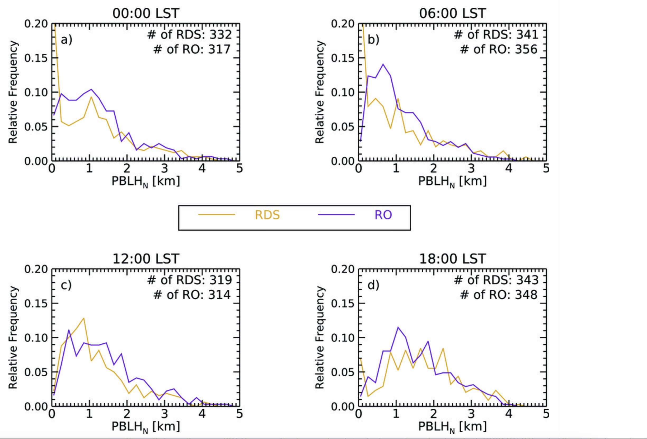
03 January 2021: A new journal article titled: "Diurnal Variation of the Planetary Boundary Layer Height Observed from GNSS Radio Occultation and Radiosonde Soundings over the Southern Great Plains", has been published in the Journal of Atmospheric and Oceanic Technology (JTEC) of the American Meteorological Society. This study demonstrates that GNSS RO is capable of capturing the diurnal and seasonal variations of the Planetary Boundary Layer Height (PBLH) over the southern Great Plains as compared to the collocated radiosonde observations.
The article stems from collaborative work conducted between Texas A&M University and JPL, and the research was leveraged through the JPL summer internship program. The lead author is PhD Candidate Kevin Nelson who is advised by Dr. Feiqin Xie. JPL co-authors Dr. Chi Ao and Dr. Mayra Oyola-Merced served as mentors during the summer internship.
To access the full article visit: https://doi.org/10.1175/JTECH-D-20-0196.1

Calibrated Polarimetric Radio Occultation for Heavy Precipitation (PAZ-ROHP) Data Now Available for Download
08 December 2021: Calibrated Polarimetric PAZ Data is now available for FTP Download through the NASA JPL GENESIS portal .
About ROHP-PAZ: The Spanish Earth Observation PAZ satellite, launched on Feb 22, 2018, carries a Synthetic Radar Aperture (SAR) as primary and sole payload and a polarimetric GNSS Radio-Occultation (RO) payload, the latter enables the radio occultation capabilities of IGOR+, together with the acquisition and installation of a GNSS antenna oriented towards the limb of the Earth.
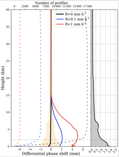
Moreover, ROHP-PAZ is a proof-of-concept experiment: for the first time ever, GNSS RO measurements have been taken at two polarizations, to exploit the potential capabilities of polarimetric radio occultation for detecting and quantifying heavy precipitation events. Consequently PAZ provides coincident thermodynamic and precipitation information with high vertical resolution within regions with thick clouds.This might help understanding the thermodynamic conditions underlying intense precipitation, which is relevant because these events remain poorly predicted with the current climate and weather model parametrization. A better understanding of the thermodynamics of heavy precipitation events is necessary towards improving climate models and quantifying the impact of climate variability on precipitation.
For more information on PAZ, please visit: https://paz.ice.csic.es/introduction.php?idi=EN
For more information on the calibration process, we recommend:
Padullés, R., Ao, C. O., Turk, F. J., de la Torre Juárez, M., Iijima, B., Wang, K. N., and Cardellach, E.: Calibration and validation of the Polarimetric Radio Occultation and Heavy Precipitation experiment aboard the PAZ satellite, Atmos. Meas. Tech., 13, 1299–1313, https://doi.org/10.5194/amt-13-1299-2020 , 2020.

Dr. Chi Ao Featured on Sentinel-6 JPL News
20 October 2020: The joint U.S.-European Sentinel-6 Michael Freilich is the next in a line of Earth-observing satellites that will collect the most accurate data yet on sea level and how it changes over time. With millimeter-scale precision, data from this mission will allow scientists to precisely measure sea surface height and gauge how quickly our oceans are rising. The Sentinel-6 Michael Freilich satellite is part of the Sentinel-6/Jason-CS mission, a collaboration among NASA, ESA, EUMETSAT, and NOAA. Sentinel-6 Michael Freilich will launch from Vandenberg Air Force Base in California no earlier than Nov. 10, 2020. For more information on the Sentinel-6/Jason-CS mission, go to https://www.nasa.gov/subject/18859/se... Credit: NASA-JPL/Caltech/NOAA
